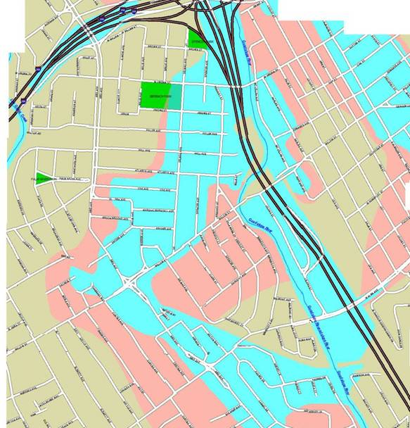
a decade ago, the SCVWD had an interactive map that showed the flood zones near a given address. [I don't find it on their website anymore.) By cut-and-pasting, I was able to create an overall map of the flood zone in Willow Glen (it's online at http://www.wgbackfence.net/floodmap.jpg, a detail of which is shown here). The Los Gatos Crk is at the left edge here, and the trestle just off the map. If there had been water anywhere other than in the channel itself, I certainly would have folded those areas into this map. The implication: the SCVWD did/does not consider the trestle to be a flood hazard. (In other reports, the 100-year flood-line is shown as coming only 2/3rd the trestle.)
Also, if the SCVWD viewed the trestle as a hazard, I doubt that they would have given the City of San Jose a half-million dollars to restore it.
[BTW: the flooding in WG is caused mainly by Ross Creek jumping its banks out near Branham Lane and then following the original shallow waterway towards the Bay, only diverted a little near Alma by the grade for the old railroad.]