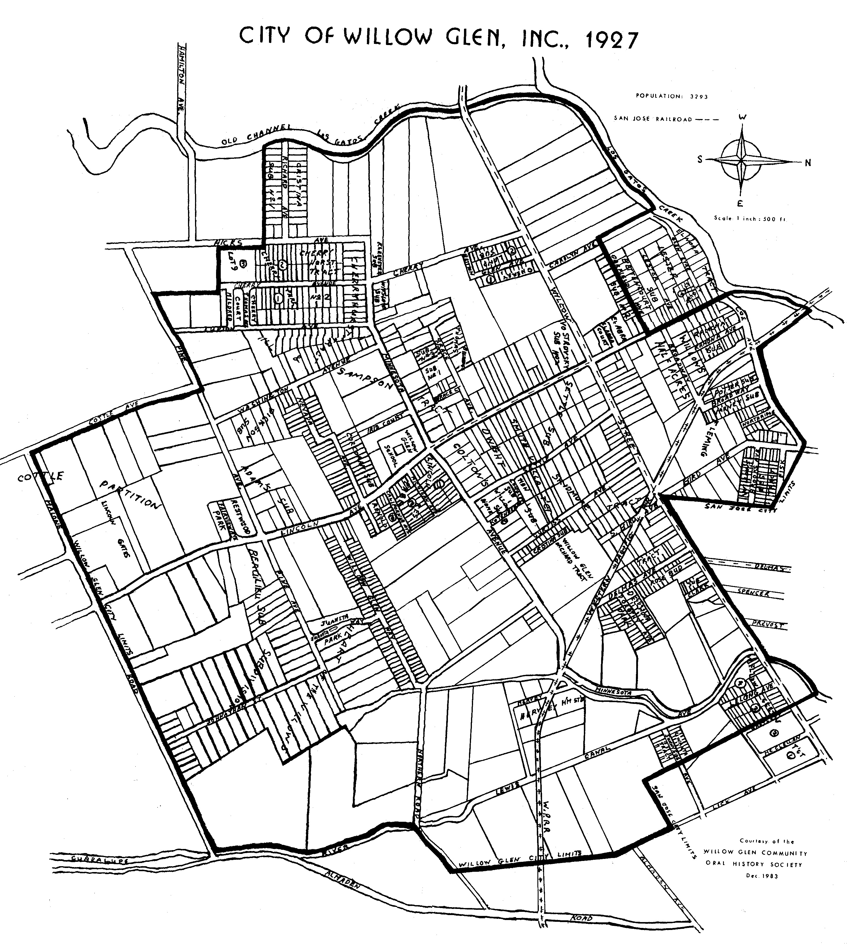
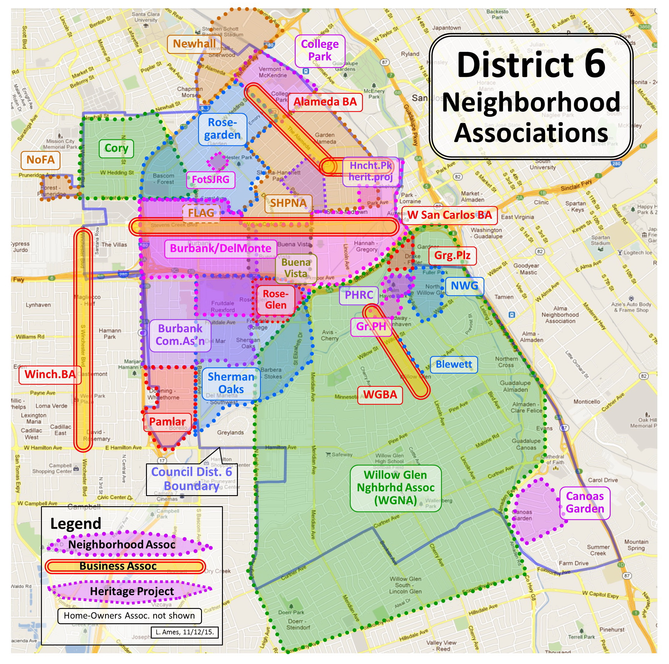
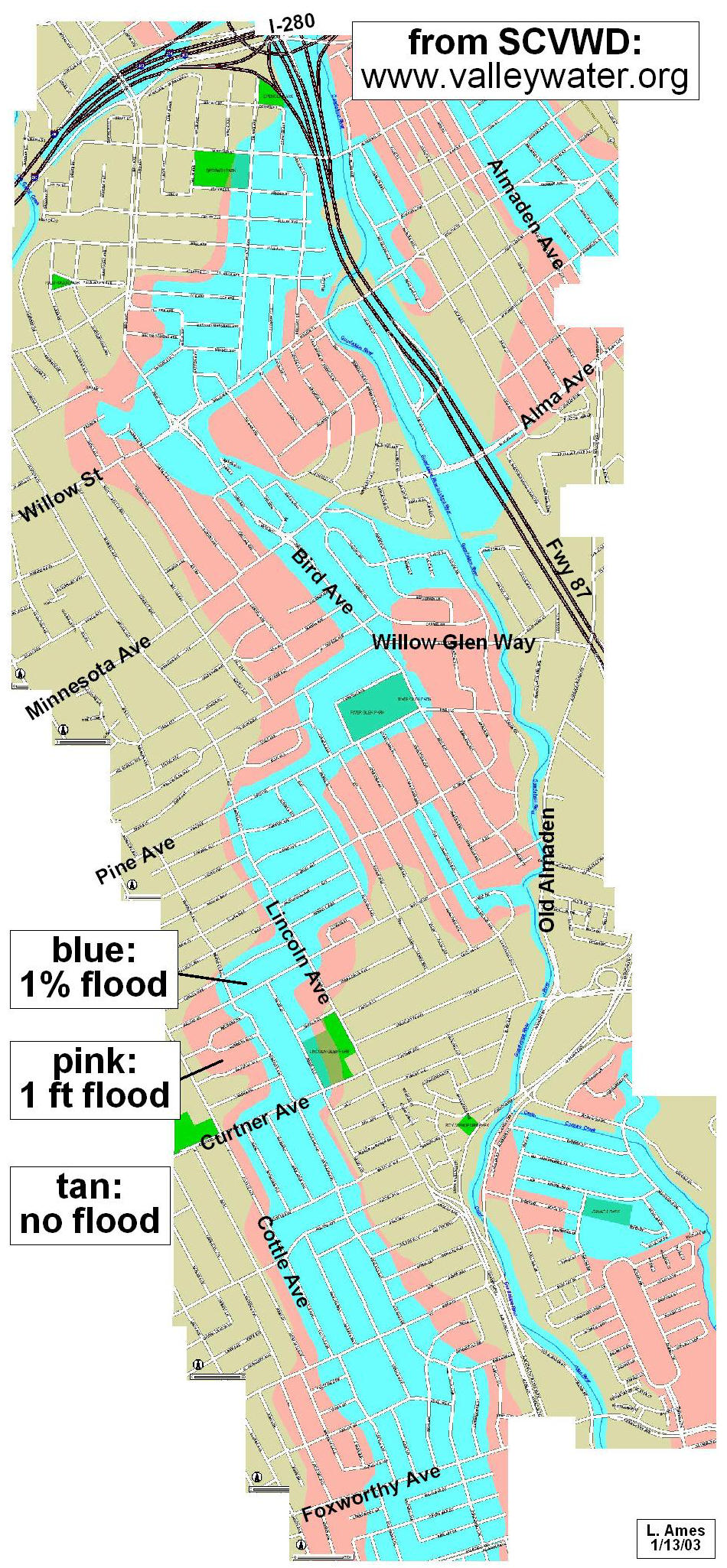
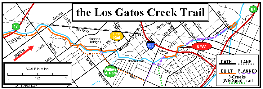
Maps of Willow
Glen and environs:
|
|
|
|
|
|
|
The Santa Clara
County Bikeways map |
|
|
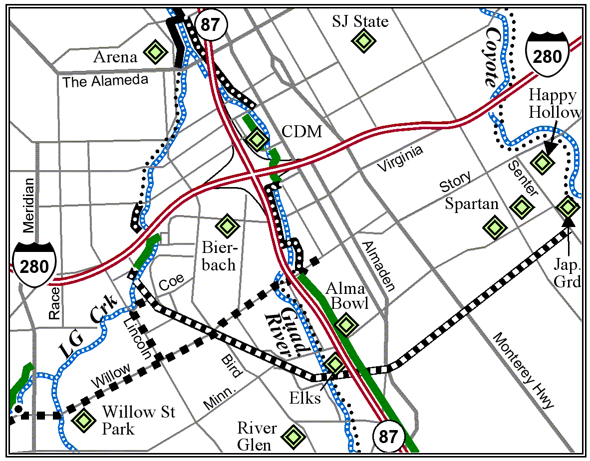
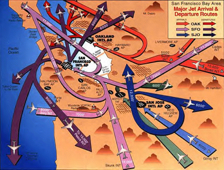
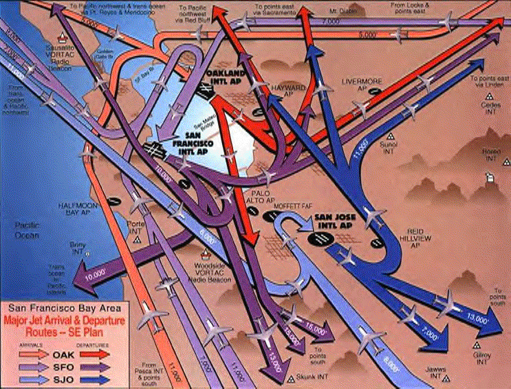
San Jose Int'l
Airport |
[300kB .PDF
file:
|
|
|
|
|
|
|
|
|
|
|
|
|
Last revised 6/4/11
by L. Ames.